Category
- COVID-19 Coverage
- Biomass
- Business
- Carbon Capture
- Climate change
- Coal
- Connected Plant
- Courts
- Cybersecurity
- Distributed Energy
- Distributed Power
- Electric Vehicles
- Energy Storage
- Environmental
- Finance
- Fuel
- Fuel Cells
- Gas
- Geothermal
- HR
- Hydro
- Hydrogen
- IIOT
- Instrumentation & Controls
- International
- Legal & Regulatory
- Legislative
- Markets
- Marmaduke
- Nuclear
- Ocean/Marine
- O&M
- Physical security
- Plant Design
- Power Demand
- Renewables
- Research and Development
- Safety
- Smart Grid
- Solar
- Supply Chains
- Synfuel
- Technology
- Tidal Power
- Top Plant
- T&D
- Waste to Energy
- Water
- Wind
- Workforce
© 2024 Access Intelligence, LLC - All Rights Reserved
PAGES
CATEGORIES
- COVID-19 Coverage
- Biomass
- Business
- Carbon Capture
- Climate change
- Coal
- Connected Plant
- Courts
- Cybersecurity
- Distributed Energy
- Distributed Power
- Electric Vehicles
- Energy Storage
- Environmental
- Finance
- Fuel
- Fuel Cells
- Gas
- Geothermal
- HR
- Hydro
- Hydrogen
- IIOT
- Instrumentation & Controls
- International
- Legal & Regulatory
- Legislative
- Markets
- Marmaduke
- Nuclear
- Ocean/Marine
- O&M
- Physical security
- Plant Design
- Power Demand
- Renewables
- Research and Development
- Safety
- Smart Grid
- Solar
- Supply Chains
- Synfuel
- Technology
- Tidal Power
- Top Plant
- T&D
- Waste to Energy
- Water
- Wind
- Workforce
Current POWER Magazine Issue

We are first in your inbox with the most important news in the industry?keeping you smarter and one-step ahead in this ever-changing and competitive market.
Start your free subscription) 2020 Access Intelligence, LLC - All Rights Reserved
Research Library
The top resource for free research, white papers, reports, case studies, magazines, and eBooks.
Close
- Agriculture
- Automotive
- Career
- Construction
- Education
- Engineering
- Finance
- Food and Beverage
- Government
- Healthcare and Medical
- Human Resources
- Information Technology
- Data Infrastructure
- Data Tools
- Desktops, Laptops and OS
- Chip Sets
- Collaboration Tools
- Desktop Systems - PCs
- Email Client
- Embedded Systems
- Hardware and Periferals
- Laptops
- Linux - Open Source
- Mac OS
- Memory Components
- Mobile Devices
- Presentation Software
- Processors
- Spreadsheets
- Thin Clients
- Upgrades and Migration
- Windows 7
- Windows Vista
- Windows XP
- Word Processing
- Workstations
- Enterprise Applications
- IT Infrastructure
- IT Management
- Networking and Communications
- Bluetooth
- DSL
- GPS
- GSM
- Industry Standard Protocols
- LAN - WAN
- Management
- Mobile - Wireless Communications
- Network
- Network Administration
- Network Design
- Network Disaster Recovery
- Network Interface Cards
- Network Operating Systems
- PBX
- RFID
- Scalability
- TCP - IP
- Telecom Hardware
- Telecom Regulation
- Telecom Services
- Telephony Architecture
- Unified Communications
- VPNs
- VoIP - IP Telephony
- Voice Mail
- WAP
- Wi-Fi (802.11)
- WiMAX (802.16)
- Wide Area Networks (WAN)
- Wireless Internet
- Wireless LAN
- Security
- Servers and Server OS
- Software and Web Development
- .Net Framework
- ASPs
- Application Development
- Application Servers
- Collaboration
- Component-Based
- Content Management
- E-Commerce - E-Business
- Enterprise Applications
- HTML
- IM
- IP Technologies
- Integration
- Internet
- Intranet
- J2EE
- Java
- Middleware
- Open Source
- Programming Languages
- Quality Assurance
- SAAS
- Service-Oriented Architecture (SOA)
- Software Engineering
- Software and Development
- Web Design
- Web Design and Development
- Web Development and Technology
- XML
- Storage
- Life Sciences
- Management
- Manufacturing
- Marketing
- Meetings and Travel
- Multimedia
- Operations
- Retail
- Sales
- Trade/Professional Services
- Utility and Energy
- View All Topics
- Featured eBooks
- Trending Resources
- New Resources
- Promote Your Content
- Partnership Opportunities
- Get RSS Updates
- About TradePub.com
- FAQ
- Contact Us
Share Your Content with Us
on TradePub.com for readers like you. LEARN MORE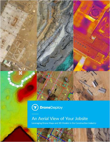

Request Your Free eBook Now:
"An Aerial View of Your Jobsite"
Leveraging Drone Maps & 3D Models in the Construction Industry
In this eBook, we explore how construction teams use drones to generate collaborative maps and 3D models, leverage data from high-resolution point clouds, and even create accurate contour maps. We also give examples of how industry leaders like Brasfield & Gorrie, Choate Construction, and McCarthy Building Companies handle safety, implementation, and scale in their drone programs.
Drones are quickly becoming a must-have tool on any jobsite. Whether your team already has a drone, or you’re just beginning to consider the idea, we’re confident you’ll come away with a better understanding of how drones can help you streamline and improve your daily workflows, save time, and create more informed, collaborative teams.
Download the eBook today.
Offered Free by: DroneDeploy
See All Resources from: DroneDeploy
Recommended for Professionals Like You: